The map under the robot: how game scans became navigation infrastructure
Crowdsourced AR scans can help delivery robots find a curb — and raise harder questions when the same visual maps move toward GPS-denied drone navigation.

A sidewalk robot that keeps its lane near a café and a drone that still knows where it is when satellite navigation is jammed sound like different machines. The uncomfortable lesson from the Niantic Spatial controversy is that they can depend on the same kind of infrastructure: dense visual maps of the physical world, built from cameras pointed at streets, landmarks and doors by ordinary people.
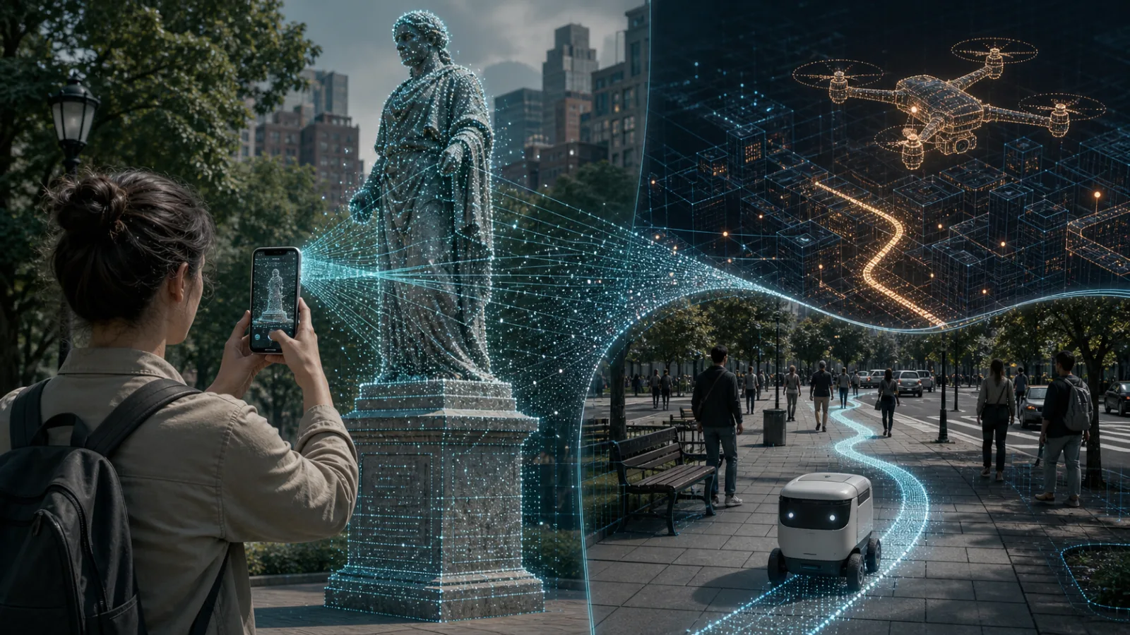
The story began in the most civilian way possible. Niantic Spatial, the company that grew out of the mapping and AR work behind Pokémon Go, announced a partnership with Coco Robotics to help delivery robots localize on sidewalks. Its Visual Positioning System compares what a camera sees with a map of recognizable visual features. In crowded urban canyons, where GPS can drift by many meters, that kind of localization is valuable: a robot needs to know whether it is beside the curb, at a pickup window, near a ramp, or blocking the wrong part of the sidewalk.
Then the same data pipeline became a defense-tech argument. Reporting by DroneXL, The Guardian and Ars Technica, drawing on Dutch coverage and official company material, connected Niantic Spatial to Vantor, the geospatial-intelligence company formerly known as Maxar Intelligence. Vantor and Niantic Spatial have described work around GPS-denied navigation for field assets such as drones, vehicles and AR glasses. The strongest verified claim is not that raw game footage is being streamed into a weapon today. It is that crowdsourced scans and images helped train visual-localization technology whose commercial future now includes robotics, public-space mapping and defense-relevant navigation.
That distinction matters. It keeps the article away from a cartoonish version of the story, but it does not make the story harmless. Robotics companies are learning that the hard part of autonomy is not only the model on the robot. It is the world model around the robot: the street corner as seen in rain and sun, the statue from ten angles, the shopfront after renovation, the alley where GPS is noisy, the building entrance that looks almost like three others. A model can be brilliant in a lab and still fail if it does not know the texture of the real place.
What visual positioning changes
Classic GPS tells a device roughly where it is on Earth. That is enough for a car navigation arrow, but often not enough for a small robot sharing space with pedestrians. Tall buildings reflect signals. Trees and tunnels hide satellites. Jamming and spoofing can make satellite positioning unreliable in conflict zones. Visual positioning solves a different problem: the camera looks at the surroundings and asks, “Which known place looks like this from this angle?” If the reference map is rich enough, the answer can be much more precise than consumer GPS.
For robots, that precision is operational. A courier robot that is one meter off may be in the walking path rather than beside it. A warehouse robot may miss a loading bay. A drone inspecting damage after a storm may need to hold position near a façade where GPS multipath is severe. In military language, the same ability becomes navigation when GNSS is denied by jamming, interference, spoofing or indoor operation. The technology is not morally one thing; the operator and deployment context decide whether it delivers groceries, supports rescue, or guides a military asset.
Niantic’s AR history gave it a rare asset: people were already willing to move through the world with phones raised. Pokémon Go, Ingress and later scanning features encouraged users to visit landmarks and sometimes submit scans for rewards. Popular Science, citing Niantic Spatial’s civil robotics push, described more than 30 billion images as part of the training story. The exact composition of that corpus matters — game images, AR mapping scans, Scaniverse captures and other spatial products should not be flattened into a single bucket — but the strategic value is clear. Repeated consumer scans make a city legible to machines.
Why the Coco Robotics case is easy to understand
The Coco partnership is the cleanest civil example. Delivery robots are physically present, slow, visible and constrained by sidewalks. They need localization not as a science-fiction extra, but as basic reliability. A robot has to approach a restaurant, cross driveway cuts, avoid wandering into the street, and stop where a customer can actually find it. GPS alone does not give that level of confidence in many cities.
Niantic Spatial’s own language about the Coco partnership emphasizes exactly that: accurate geolocation where GPS fails, improved location precision, and safer navigation to pickup zones. John Hanke’s line to MIT Technology Review, repeated by Popular Science, captured the engineering connection neatly: making Pikachu appear in the right place and making a Coco robot move accurately through the world are versions of the same spatial problem. The cute consumer interface and the delivery robot share a deeper requirement: a map that aligns pixels from a camera with coordinates in the world.
For readers who care about robotics, this is a useful reality check. Autonomy is not only a better perception model on a device. It is a stack: sensors, localization, maps, fleet operations, maintenance, legal permissions and public acceptance. The map layer is easily ignored because it is invisible when it works. But when a robot crosses the wrong driveway, blocks a wheelchair user, or fails near a high-rise, the map suddenly becomes very visible.
Why the Vantor connection changed the temperature
The controversy intensified because Vantor is not a pizza-delivery company. It is a geospatial-intelligence business with defense and national-security relevance. Public descriptions of the Vantor-Niantic Spatial partnership discuss fusing ground-level localization with aerial navigation and enabling operation where GPS is unavailable or unreliable. Those phrases are routine in robotics and defense procurement, but they land differently when the upstream data story includes scans gathered through consumer games.
The careful reading is this: current evidence supports a concern about model training, downstream partnerships and dual-use infrastructure. It does not prove that an individual player’s scan of a park sign is directly inside a deployed military drone today. Vantor has been reported as saying it would not use game data for its system, while the harder question — whether early models or foundation components were influenced by historical game-derived scans — is precisely where public transparency becomes thin. Once visual features have helped train a model, ordinary deletion language can become less meaningful than users expect.
That is why the Hacker News discussion was unusually sharp. Some commenters argued that the headline overstated the military link; others said the backlash was predictable because every large consumer platform eventually finds more valuable uses for its data. The most durable objections were about consent and auditability. A player can understand “scan this PokéStop for a reward.” It is much harder to understand “your scan may become part of a spatial model licensed years later into robotics, city mapping, public-safety systems, industrial inspection or defense navigation.”
Consent is not the same as imagination
Most technology companies can point to terms that grant broad rights to user-submitted content. That is not the end of the ethics question. Consent in a long legal document often covers more than a normal person can realistically imagine. A user may accept that a scan improves AR placement in a game. They may even accept that it improves a delivery robot. They are far less likely to picture GPS-denied navigation, defense contractors, export-sensitive geospatial products or field assets.
The gap is not solved by saying the scan was optional. Optional features can still be nudged with rewards, scarcity, community pressure or default prompts. Nor is it solved by saying the data is of public places. A single photograph of a statue is ordinary; billions of repeated views of streets, façades, routes and entrances become an industrial map. Density changes the category. So does the ability to query, fuse and sell the map.
For robotics companies, this is now a reputational risk as much as a privacy risk. The industry needs real-world data. Simulators are improving, but robots still need to survive rain, glare, construction, graffiti, temporary barriers, uneven sidewalks and new storefronts. If the cheapest path to that knowledge is quietly repurposing data from games and consumer apps, the backlash will arrive after the technical milestone instead of before it.
What should be separated in public claims
Four claims are often mixed together and should stay separate. First, there is the verified civil robotics claim: Niantic Spatial’s visual positioning can help Coco Robotics localize delivery robots where GPS is weak. Second, there is the historical training claim: consumer images and scans associated with Niantic’s products contributed to spatial models, with widely reported figures around 30 billion images. Third, there is the dual-use partnership claim: Vantor and Niantic Spatial are working on navigation for GPS-denied environments relevant to drones, vehicles and field assets. Fourth, there is the strongest allegation: that Pokémon Go player scans are directly powering military drones.
A serious robotics publication should not collapse those into one sentence. The fourth claim needs the most caution. The first three are enough to make the issue important. The reason is simple: autonomy infrastructure moves across markets. A localization system built for a robot courier can be attractive to inspection drones, logistics vehicles, AR headsets, emergency response teams and armed forces. The same map can be sold under different labels.
The public-space problem
Public-space scanning sits between categories that law and platform policy often treat separately. It is not exactly private home video, not exactly street photography, not exactly critical-infrastructure mapping, and not exactly a military geospatial product. A phone camera pointed at a monument may also catch apartments, school entrances, license plates, protest posters, security cameras and patterns of movement. Even if faces and plates are blurred or filtered, geometry remains valuable.
Cities will eventually have to ask who may build dense visual maps of sidewalks and façades, how those maps can be exported, whether contractors can sell them into defense markets, and what rules apply to scans near schools, hospitals, transport hubs and critical infrastructure. The question is not whether robots are allowed to see. Every autonomous system must sense. The question is whether a privately controlled visual layer of the city becomes infrastructure without public debate.
What users can realistically do
Individual users can reduce their contribution: avoid optional scanning tasks, avoid scanning interiors and sensitive sites, review app permissions, request data downloads or deletion where tools exist, and choose services that explain downstream use plainly. Those steps are sensible, but they are not enough. The user cannot audit model weights. They cannot know which partner will exist in three years. They cannot negotiate a separate defense-use clause inside a mobile game prompt.
That is why the answer has to move upstream. Companies collecting spatial data should label downstream use in plain language before collection: game improvement, AR placement, robot navigation, mapping products, government use, defense use. They should separate consent for sensitive categories rather than burying everything under a broad content license. They should say whether scans can be removed before model training, whether trained models can be audited for data lineage, and whether minors or school-adjacent scans are handled differently.
What robotics companies should learn
The Niantic Spatial episode is not a reason to abandon visual localization. It is a reason to govern it. Robots will need shared maps, and those maps will often come from fleets, phones, cars, drones and glasses. The companies that handle this honestly will have an advantage: provenance logs, city agreements, deletion windows, partner restrictions, and transparent “where this data may go” labels are not bureaucracy. They are part of deploying robots in public.
The technical future is clear enough. More machines will navigate by matching camera feeds to dense world models, not by trusting GPS alone. The social future is unsettled. People helped map the world because it made a game more magical and a phone camera more useful. Now that same kind of map may guide delivery robots, inspection drones and defense-relevant systems. The next fight in robotics is therefore not just whether machines can find their way. It is whether the people who helped build the map knew where that map could lead.
Related articles
Drones did not kill the tank; they changed the robotics around it
Combined Resolve and Aurora 26 show why small drones, operators and fast feedback loops now matter as much as heavy machines.

A robotaxi map is not a service
Tesla’s Miami geofence and Waymo’s standing-water recall show that the real robotaxi race is no longer about drawing bigger maps. It is about proving the operating domain.
Service robots need operations before hype
A grounded robotics article about why service robots succeed through route design, support, safety cases and unglamorous operations.
Robotaxis at the school gate: what the Waymo probe really tests
NHTSA’s redacted Waymo file turns a low-speed Santa Monica collision into a bigger question about robotaxi caution and public evidence.
Comments
Sign in to comment.
No comments yet.