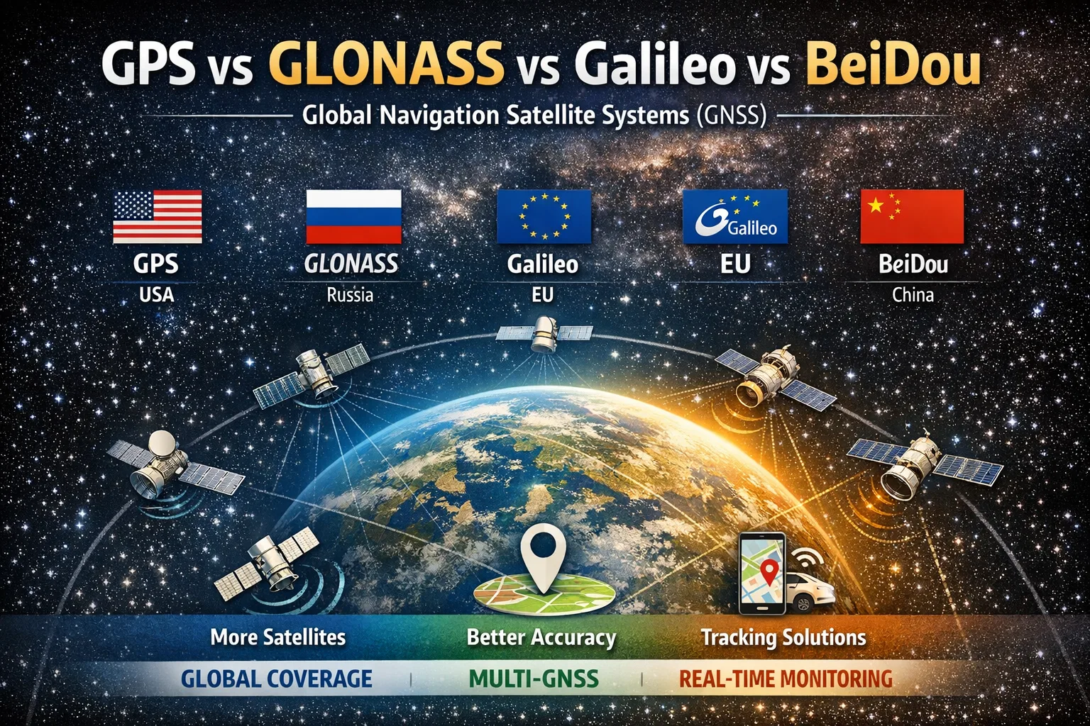
GPS vs GLONASS vs Galileo vs BeiDou: What’s the Difference?
Discover the differences between GPS, GLONASS, Galileo, and BeiDou. Learn how global navigation satellite systems work, why modern devices use multiple GNSS simultaneously, and how tracking platforms turn satellite positioning data into real-world applications.
Why are there so many global navigation satellite systems?
The answer is simple — independence.
Each global navigation satellite system (GNSS) is owned and operated by a specific country or group of countries:
- GPS — United States
- GLONASS — Russia
- Galileo — European Union
- BeiDou — China
This means each system can provide positioning services independently of the others.
What GNSS systems exist today?
There are not only global systems, but also regional ones.
🌍 Global GNSS
- GPS
- GLONASS
- Galileo
- BeiDou
These systems provide worldwide coverage.
🌐 Regional systems
Some countries operate regional navigation systems designed to enhance positioning in specific areas:
- NavIC (India) — covers India and nearby regions
- QZSS (Japan) — improves positioning accuracy in Japan, especially in urban environments
These systems complement global GNSS rather than replace them.
⚙️ Augmentation systems (SBAS)
These are not standalone GNSS, but systems that improve accuracy:
- EGNOS (Europe)
- WAAS (USA)
- MSAS (Japan)
They are widely used in aviation and professional navigation.
Which system is better?
In practice, all GNSS are based on the same principle:
devices receive signals from satellites and calculate their position.
The main differences are:
- age of the system
- number of satellites
- orbital configuration (altitude, inclination, etc.)
GPS was the first system and became the global standard. Because it has been around the longest, it is the most widely used and trusted.
Orbital configuration affects accuracy, especially in specific regions.
For example, GLONASS tends to perform better in northern latitudes due to its orbital design.
What is BeiDou and how is it different?
BeiDou is China’s global navigation system, fully operational since 2020.
Key features:
- more than 40 satellites
- a mix of orbit types (geostationary, medium Earth orbit, inclined geosynchronous)
- strong coverage and reliability, especially in Asia
- additional services such as short message communication
In terms of accuracy and capabilities, BeiDou is now on par with other global GNSS.
Which GNSS should you choose?
For most users, choosing a single GNSS is not necessary — and often not even possible.
Modern devices automatically use multiple systems at once.
This is intentional:
the more satellites available, the better the accuracy and reliability.
How it works in real-world applications
GNSS systems (GPS, GLONASS, Galileo, BeiDou) only provide raw satellite signals.
Devices — such as GPS trackers or smartphones — use these signals to calculate their position.
Tracking platforms like LiveGPSTracks operate at the next level:
they receive already calculated coordinates from devices and turn them into useful insights and tools.
For example, LiveGPSTracks allows you to:
- track objects in real time
- view movement history
- analyze routes and stops
- manage geofences and events
In simple terms:
👉 GNSS — provide raw signals
👉 devices — calculate position
👉 tracking platforms — turn data into actionable information
Evolution of GNSS receivers
- Before ~2007 — mostly GPS-only devices
- 2007–2015 — GPS + GLONASS
- After 2018 — Galileo added
- Modern devices — GPS + GLONASS + Galileo + BeiDou
How to check which GNSS your phone uses
There are many apps that can show:
- number of satellites in use
- which GNSS they belong to
- signal quality
Most modern smartphones use multiple GNSS simultaneously.
Conclusion
Today, GNSS systems are not competitors — they form a unified ecosystem.
The best results come from using multiple systems together:
- more satellites
- better coverage
- higher accuracy
That’s why modern devices rely on a combination of GPS, GLONASS, Galileo, and BeiDou.
Comments
Sign in to comment.
No comments yet.