ROAM Shows How Vision-Language Models Can Guide Legged Robots Without Driving Their Legs
ETH Zurich’s ROAM system uses a vision-language model to interpret terrain, signs, and hazards, then passes that information to conventional mapping and locomotion policies. Its real test is the boundary between semantic judgment and physical control.

ROAM’s central design choice: language models judge the scene, not the motors
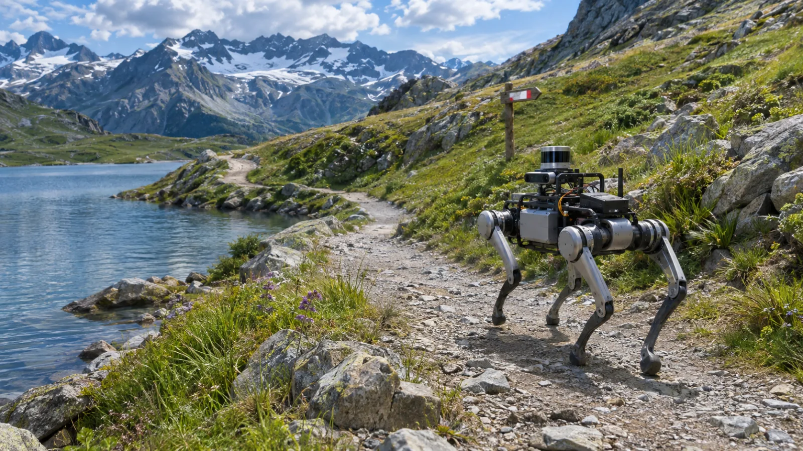
ROAM is built around a division of labor. A vision-language model is asked to interpret what the robot sees—terrain, hazards, areas that appear preferable for travel, and signs—while separate navigation and locomotion components remain responsible for turning that interpretation into movement. The distinction matters because recognizing a scene and controlling a walking machine are different problems. A model that can describe a trail, identify a warning, or compare two surfaces is not automatically a reliable source of walking commands.
The system therefore does not ask the vision-language model to output coordinates or speeds. Instead, it uses the model’s semantic judgments as navigation information. The model names things in view and assigns them navigation-related risk values, while an open-vocabulary segmentation module finds those categories in the camera image, pixel by pixel. The result is a dense, real-time risk map: a spatial representation in which each visible region receives a preference for going or avoiding. The ROAM project page describes the basic logic plainly: the model says what is in view and how risky it is, and the robot turns that assessment into where to walk.
That interface lets the system represent distinctions that a purely geometric view of the world may miss. It is not only a question of whether a patch of ground appears physically traversable. A lake, a risky surface, an animal, or a sign can change the preferred route even when the geometry alone does not provide a complete reason to choose one direction over another. In ROAM, such semantic judgments are converted into values that can be fused with the robot’s spatial representation rather than being left as an unstructured textual answer.
The risk map then conditions two pre-trained reinforcement-learning policies: one for local navigation and one for agile locomotion. Those policies handle the fast and precise parts of the pipeline. The paper describes this as a coupling of high-level vision-language reasoning with low-level physical control, while the official repository explains that semantic images are fed into an elevation map used by the robot’s navigation and locomotion policies. The language model supplies a judgment about the environment; the learned control stack uses that judgment while remaining responsible for route selection and walking behavior.
This separation is important because a raw instruction such as “go over there” leaves the physical problem underspecified. Which surface should be preferred? Which obstacle should be avoided? Does a visible sign alter the route? A risk map gives downstream policies a structured answer to those questions without requiring the language model to predict every foot placement, body motion, or contact with the ground. It contributes an assessment of the visible scene, while the policies retain responsibility for making movement feasible.
The approach also avoids limiting semantic perception to a small, fixed list of categories. Because the segmentation stage is open-vocabulary, the system can use language-based descriptions to identify relevant regions instead of relying only on classes defined in advance. The project materials show the model assigning values to examples such as a gravel path, grass, and a cow, then turning those labels into per-pixel maps. The exact label is not the final action; it becomes part of a spatial cost signal that the navigation system can use.
The boundary between the two layers should nevertheless remain explicit. A risk map is an intermediate judgment, not a guarantee that a route is safe. If the semantic interpretation is wrong, the controller may receive a misleading preference over terrain or an incorrect warning about the scene. Conversely, a correct label does not remove the physical uncertainty of walking over uneven ground. ROAM’s design is useful precisely because it keeps those responsibilities separate: semantic reasoning can influence where a legged robot chooses to go without being treated as a substitute for the systems that make each step physically possible.
That makes ROAM a study of system composition as much as of model capability. Its central question is whether a vision-language model can provide sufficiently useful, spatially grounded judgments for established navigation and locomotion policies to exploit. The relevant object is therefore the complete pipeline—from visual interpretation, through open-vocabulary segmentation and risk estimation, to learned route selection and walking—not an isolated language-model demonstration. The system’s promise lies in connecting broad scene understanding to a control stack that already knows how to move; its difficulty lies in ensuring that the connection remains reliable when the meaning of the scene affects the safest path.
What the field demonstrations actually establish
ROAM’s field evidence extends beyond a carefully staged indoor obstacle course. The project materials show the legged robot operating across alpine trails, forest, grass, roads, indoor spaces, smoke, train tracks, and urban environments containing signs. This variety matters because each setting changes what “safe” means. A route may be geometrically open yet undesirable because it crosses tall grass, approaches a track, enters smoke, or is closed by a construction sign. The demonstrations therefore test whether semantic scene understanding can influence route choice while the robot remains responsible for physically walking over the terrain. (ROAM project page; arXiv paper)
The project page highlights two longer outdoor runs: a 2.4 km demonstration at Seealpsee and a 10.1 km demonstration at Zermatt. Those distances provide evidence of sustained route execution rather than a single successful step or a brief visual reaction. The Zermatt route included gravel, rock, grass, lakesides, and train tracks; the Seealpsee route followed a loop around a mountain lake. The result is meaningful precisely because the system had to keep integrating changing visual context over a route, not merely classify one isolated image. Still, the runs establish a demonstrated capability under the reported conditions, not a guarantee that the robot can navigate every similar trail or interpret every sign correctly.
The field trials also show why “autonomous” needs to be read carefully. ROAM is described as completing kilometer-scale hikes with minimal intervention, and the longer videos present route execution by the robot rather than continuous remote steering. That supports a specific claim: the navigation loop can carry the platform through extended real-world environments while using semantic information to decide where to go. It does not establish general-purpose autonomy, indefinite operation without supervision, or reliable recovery from every perception and control failure. A successful demonstration remains bounded by its route, equipment, configuration, and the kinds of situations represented in the test.
The system’s division of labor is central to interpreting the result. The vision-language model does not directly drive the robot’s joints. Instead, it describes visible terrain and hazards, assigns semantic risk, and supplies information that downstream modules convert into navigation and locomotion behavior. ROAM combines that semantic layer with pre-trained learned policies: one for local navigation and another for locomotion. The project repository describes the pipeline as producing semantic images that are fused with an elevation map, which the robot’s navigation and locomotion policies can use. (ROAM code repository)
That architecture makes the demonstrations technically informative. A robot can already walk using learned control, but walking competently is not the same as choosing the socially or physically sensible route. The field examples show the semantic layer changing the meaning of otherwise similar terrain. Urban signs can tell the robot to leave a path; train tracks can make one side of a route preferable; smoke changes the visual conditions under which decisions are made. In the project’s indoor-to-outdoor run, the same system moves from a building through campus areas and onward to fields, forest trails, and farm roads, with the visual labels changing as the surroundings change. The evidence is therefore about system continuity across places, not only about performance in one specially tuned environment.
The role of pre-trained policies sets a further boundary. ROAM is an interface between open-ended visual-language reasoning and learned physical control, not a replacement for the locomotion machinery. The robot’s ability to take stable steps still depends on policies trained for movement, while the semantic component helps determine which regions should be preferred, avoided, or treated as non-steppable. The field runs show that these components can be coupled on a moving legged platform. They do not show that the language model alone understands terrain, plans a complete route, and controls the body from raw pixels.
Taken together, the demonstrations establish a credible research result: semantic guidance can be connected to a legged robot over kilometer-scale outdoor routes and across a broad set of natural, urban, indoor, and degraded-visibility scenes. Minimal intervention and route completion are important evidence of integration. They should not be expanded into proof of robust autonomy in every weather condition, lighting situation, terrain type, or sign context. The strongest conclusion is narrower: ROAM demonstrates that a vision-language model can contribute useful high-level judgments to a navigation stack whose fast, precise movement remains the responsibility of conventional mapping and learned control.
Why semantic risk maps are useful—and still fragile
A map built only from geometry can answer an important but incomplete question: where can the robot physically place its feet? It can represent slopes, gaps, obstacles, and other properties inferred from shape or depth. It cannot, by itself, reliably express why two surfaces that look similarly traversable should lead to different decisions. Water may be undesirable even when its surface appears flat. Tall grass may conceal terrain that is difficult to judge from geometry alone. A closed trail, warning sign, or construction marker may change the route without changing the immediate shape of the ground. In these cases, the navigation problem is not just to find free space; it is to interpret what that space means in context.
That is the reader-level value of ROAM’s semantic risk-map design. The vision-language model can attach task-relevant meaning to what the robot sees, while open-vocabulary segmentation helps project that judgment into spatial regions rather than leaving it as a sentence or a single label. A downstream navigation policy can then treat those regions as costly, preferred, or risky while still relying on separate learned policies for route following and locomotion. The arrangement gives the language model a useful role without requiring it to calculate every motor action. The system can therefore combine scene interpretation with the geometric and control machinery that already handles movement.
The distinction matters because semantic judgment is inherently less stable than measuring a local physical feature. A depth estimate or elevation change can be checked against the robot’s sensors and map. The meaning of a sign depends on recognizing its visual content and relating it to the route. The significance of water, vegetation, smoke, or a blocked path depends on the task and on what the robot is expected to avoid. A model may notice the relevant object yet assign the wrong priority, miss part of it, or fail to preserve the distinction when the scene changes. A risk map can make that judgment actionable, but it does not make the judgment correct by construction.
The researchers identify this reliability boundary directly. The project is not presented as evidence that a vision-language model has solved outdoor navigation, and the paper discusses remaining issues around the reliability of vision-language reasoning and spatial reasoning. Those limitations are especially important in a system that converts an interpretation into a dense spatial signal. An error in a caption may be visible to a human reader and easy to question. An error in a risk map can instead look like an ordinary navigation preference, causing the robot to take a longer route, avoid useful ground, or fail to react to a relevant hazard. The separation between semantic reasoning and control reduces the risk of asking the model for raw leg commands, but it does not remove the need to validate the semantic layer.
This is why ROAM is best read as an architectural demonstration rather than a general guarantee about foundation models in the wild. Its contribution is to show how high-level visual-language judgments can be connected to conventional mapping and learned locomotion without replacing those components. The open question is how consistently the connection holds across lighting, viewpoints, terrain appearance, signs, and unfamiliar combinations of cues. A successful field route demonstrates that the complete pipeline can work in the tested setting; it does not establish that the same semantic decisions will remain dependable whenever the environment presents a new ambiguity.
For evaluation, the most revealing question is therefore not simply whether the robot reaches a destination. It is whether the semantic map improves decisions that a geometry-only system would struggle to make, and whether its mistakes are detectable and recoverable. That calls for measuring hazard and sign errors alongside route success, examining how often a person must intervene, and testing repeated runs under changed visual conditions. It also calls for comparisons that isolate the source of the benefit: what is gained from semantic interpretation, what comes from the pre-trained navigation and locomotion policies, and what can be achieved by geometric information alone. ROAM makes that boundary explicit—and makes it the central engineering problem for the next stage of research.
Who should care, and what to test next
ROAM matters most to teams working in places where a robot’s map can become outdated faster than the terrain can be surveyed. Inspection routes, search-and-rescue scenarios, industrial sites, and outdoor facilities can all contain cues that are difficult to reduce to geometry alone: a sign may redirect traffic, a patch of vegetation may be undesirable despite appearing traversable, and a familiar path may no longer be the safest option. ROAM’s contribution is to make those cues available to the navigation stack without asking a vision-language model to control the robot’s legs directly. The model supplies semantic judgments; conventional mapping and learned navigation and locomotion policies remain responsible for turning them into movement.
That division of labor also defines the right way to assess the result. A successful demonstration shows that the robot can use semantic information during route execution, but it does not by itself establish general-purpose autonomy. The research demonstrations and project videos are evidence that this architecture can operate across varied environments, including trails, forests, grass, roads, indoor spaces, smoke, train tracks, and urban signs. They should be read as tests of a particular system assembled from a vision-language model, open-vocabulary segmentation, risk-map construction, and pre-trained control policies—not as a guarantee that the same behavior will transfer unchanged to every site or operating condition.
For practitioners, the first question is therefore not whether a foundation model can “understand” a scene in the abstract. It is whether its judgments improve the robot’s decisions at the points where a geometry-only system is ambiguous. Evaluation should report the intervention rate and describe what interventions mean: a human correction, a stopped route, a recovery behavior, or a change in the selected path. It should separately measure errors involving signs, hazards, preferred terrain, and exclusion areas. An aggregate success rate can hide the distinction between a harmless semantic mistake and a mistake that sends the robot toward a dangerous or closed area.
The evaluation should also cover the conditions under which semantic perception is likely to change. Weather and lighting need explicit treatment, as do viewpoints that make signs or hazards partly hidden. Repeatability matters: the same route should be tested more than once so that a result is not attributed to a favorable sequence of observations. Researchers and buyers should document the robot platform, the sensors, the compute needed to run the system, and which capabilities come from pre-trained policies. Those details determine whether a reported behavior is reproducible and whether the architecture can be assessed independently of a particular hardware and software configuration.
A geometry-only baseline is essential. Without it, an improvement cannot be attributed to the vision-language component rather than to route design, tuning, or the underlying locomotion policy. The comparison should use the same platform and broadly comparable sensing, then examine where the semantic risk map changes the chosen route and whether those changes reduce interventions or hazard errors. It is equally important to record cases in which the language model is uncertain, spatially imprecise, or simply wrong. The researchers identify reliability and spatial reasoning as continuing limitations, so these failures are part of the result, not inconvenient exceptions to be omitted.
The broader lesson is measured rather than revolutionary. ROAM presents a credible interface between high-level semantic judgment and low-level physical control: language-guided perception can influence where a legged robot goes while learned locomotion remains in charge of how it walks. The next step is not to remove that separation, but to test its boundaries systematically—across routes, conditions, hardware, and baselines. If future evaluations show lower intervention rates and fewer consequential sign or hazard errors without unreasonable sensing and compute demands, the architecture could become a useful pattern for navigation in changing environments. Until then, its strongest claim is narrower and more valuable: semantic risk maps offer a practical research path for adding meaning to terrain-aware navigation, while leaving the hard problem of reliable physical autonomy open.
Related articles

Halloween and Pets: A Calm, Practical Safety Plan for Candy, Costumes, Doors and Decorations
Halloween changes a home in ways pets may find confusing: open doors, unfamiliar visitors, tempting food and chewable decorations. A few simple preparations can prevent poisoning, escapes and unnecessary stress without excluding animals from the evening.


Home Assistant 2026.9’s Matter Map Is Most Useful Before You Buy Another Thread Device
Home Assistant 2026.9 adds a Matter network map that can expose weak links, missing border-router paths, and Wi-Fi assumptions. Here is what it can tell you, what it cannot, and how to use it before expanding a Thread setup.

The distracted dog walk: how to protect wildlife, livestock and your dog without ruining the outing
A new University of Surrey study links missed dog waste, wildlife disturbance and livestock encounters to divided attention. Here is a practical way to make walks safer, calmer and easier to manage.
Comments
Sign in to comment.
No comments yet.